The Simon Canyon area can be accessed by Fishermen both from the north and south sides of the River. Access on the north side of the river is from County Road 4280 off of Highway 173 just west of Aztec Bridge. The turn off for County Road 4280 is about .7 miles west from Float 'N Fish and is located on the north side of highway 173. From highway 173 travel north and east 3.1 miles on County Road 4280 (improved dirt road) to the parking lot at Simon Canyon. This parking lot is not a Navajo Lake State Park facility and provides only parking and a small rest room, the parking lot and immediate area is BLM land. There is no drinking water at this location. Occasionally people pitch tents at this location but it is not an improved campsite. From this parking lot a foot trail on on the north side of the river can provide access to almost all of the river to near the dam including ET Rock, Death Row, Baetis Bend, the Lower Flats, Texas Hole and the Cable Hole area. In some areas the trail is difficult due to cliffs rising in many areas directly north of the river. The footpath on the north side of the river from Simon Canyon parking lot to near the dam is about 3.5 miles in length.
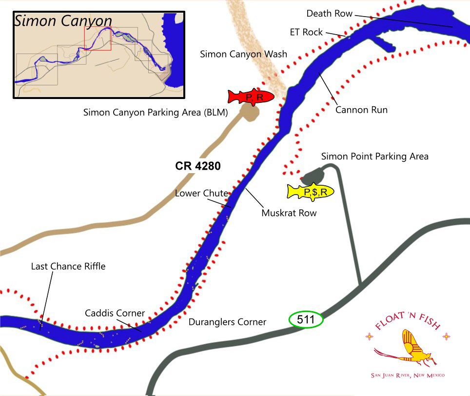
This is typically the warmest water of the Quality Water and generally supports a diverse insect population, with caddis beginning to show up in large numbers in some years in addition to Midges, Aquatic Worms, increasing populations of Mayflies, Scuds, and a few Golden Stonefly's. There are several riffles in this area including the water of Cannon Run, Muskrat Row and Last Chance Riffle. There are also some deep runs with some rock structure below Simon Canyon Wash and additional rock structure near Duranglers Corner. NM Game and Fish has been working to improve the fish habitat in this area and has built several rock structures (visible on the map) to provide additional fish cover and to channel water. Both Browns and Rainbows are present in this area, including some large fish.
A Navajo Lake State Park parking facility is located on the South side of the river off Highway 511 which provides a hiking trails along the South side of the River. In some areas these trails may be difficult also. The parking lot supports a pay station and rest rooms but no potable water.
NM Game and Fish completed Stream Improvement Projects (Phase 1, Phase 2) in the mid to lower part of this area in Nov - Dec 2005 and Nov - Dec of 2006. The projects increased stream complexity and facilitated flows by adding boulder clusters to help provide holding water and Cross Vanes to channel flows. These structures are visable on the map above.